- Power BI forums
- Updates
- News & Announcements
- Get Help with Power BI
- Desktop
- Service
- Report Server
- Power Query
- Mobile Apps
- Developer
- DAX Commands and Tips
- Custom Visuals Development Discussion
- Health and Life Sciences
- Power BI Spanish forums
- Translated Spanish Desktop
- Power Platform Integration - Better Together!
- Power Platform Integrations (Read-only)
- Power Platform and Dynamics 365 Integrations (Read-only)
- Training and Consulting
- Instructor Led Training
- Dashboard in a Day for Women, by Women
- Galleries
- Community Connections & How-To Videos
- COVID-19 Data Stories Gallery
- Themes Gallery
- Data Stories Gallery
- R Script Showcase
- Webinars and Video Gallery
- Quick Measures Gallery
- 2021 MSBizAppsSummit Gallery
- 2020 MSBizAppsSummit Gallery
- 2019 MSBizAppsSummit Gallery
- Events
- Ideas
- Custom Visuals Ideas
- Issues
- Issues
- Events
- Upcoming Events
- Community Blog
- Power BI Community Blog
- Custom Visuals Community Blog
- Community Support
- Community Accounts & Registration
- Using the Community
- Community Feedback
Register now to learn Fabric in free live sessions led by the best Microsoft experts. From Apr 16 to May 9, in English and Spanish.
- Power BI forums
- Galleries
- Data Stories Gallery
- U.S. Congressional District Boundaries Over Time
U.S. Congressional District Boundaries Over Time
11-15-2018 10:30 AM - last edited 11-16-2018 06:15 AM


- Mark as New
- Bookmark
- Subscribe
- Mute
- Subscribe to RSS Feed
- Permalink
- Report Inappropriate Content
U.S. Congressional District Boundaries Over Time
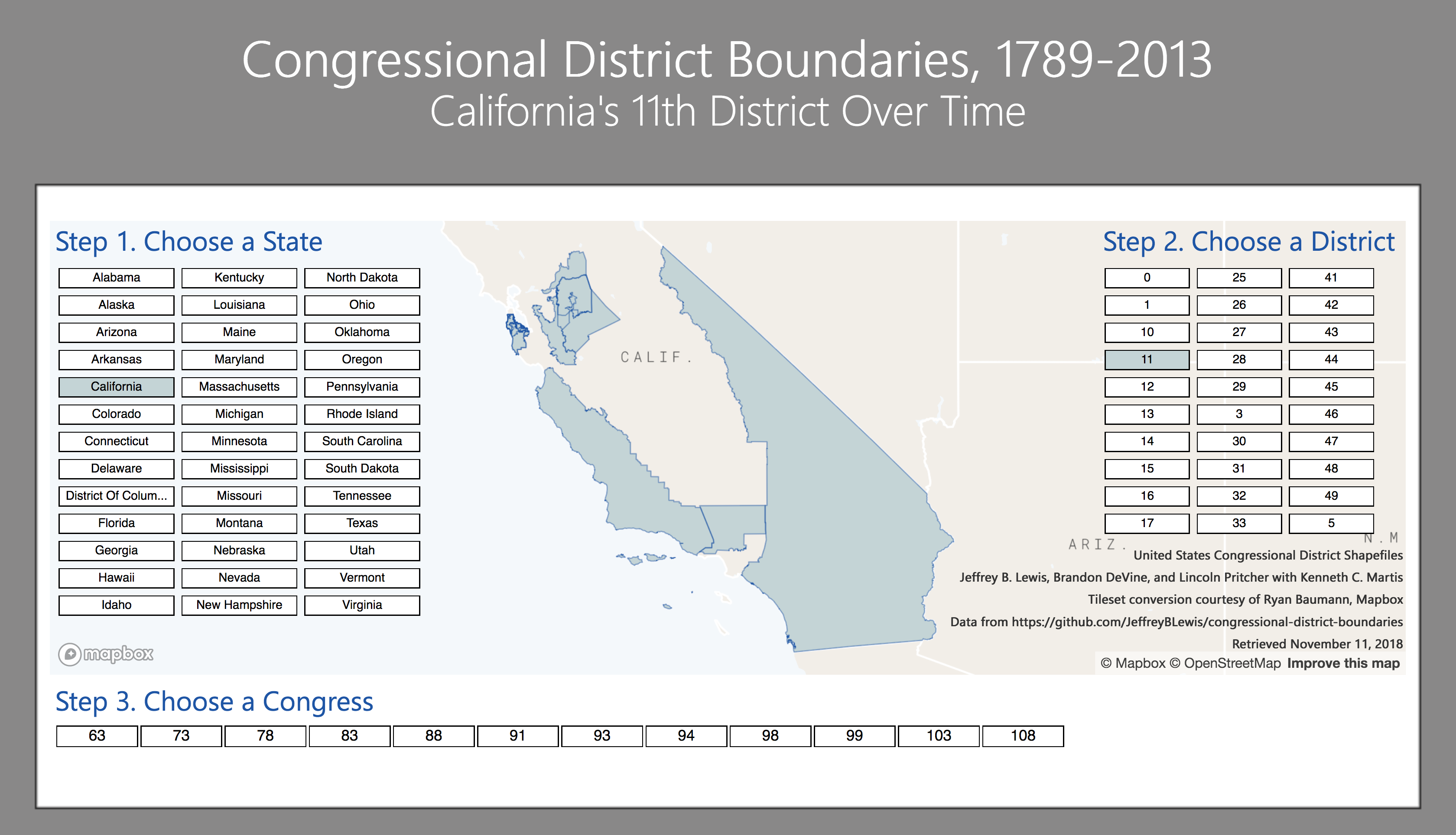
Former Massachusetts Governor Elbridge Gerry redrew the state's 1812 congressional district boundaries so bizarrely that one resembled a salamander. Thus a new term was born: gerrymandering.
This Power BI report is inspired by the ACLU's "What the District?!", a tool that visualizes 65 years of changing United States congressional district boundaries. But this report goes even further: it enables you to go back in time to see the history of these changing lines since the first session the of U.S. Congress. You can directly see how Congressional districts have been drawn — and sometimes redrawn, stretched, or curved — since 1789.
For example, California's 12th Congressional District, which is now entirely within the city and county of San Francisco, used to include parts of Los Angeles, over 400 miles away. Texas' 10th Congressional District now encompasses the Austin metro area. But at one point, it reached the Gulf of Mexico.
When Americans vote on Election Day, we must remember that redistricting is always on the ballot.
Maps in this report created with the Mapbox Visual for Power BI. Styles made in Mapbox Studio. Jeffrey B. Lewis, Brandon DeVine, Lincoln Pitcher, and Kenneth C. Martis created the GeoJSON files of all congressional district boundaries. Ryan Baumann of Mapbox converted the GeoJSON files to Mapbox tilesets. U.S. Congress sessions and dates are courtesy of the United States Senate website.
eyJrIjoiNGY4YTQ2MTYtY2EyMS00OTRhLWFlMGItZDk2YjI2YTFlZjkwIiwidCI6ImRjNTliNTFkLWVmZDItNDYyNi04M2EyLTljMmU2MzE1MTcwZiIsImMiOjZ9